
29th and 33rd Streets Safety and Mobility Project

What's happening now?
The 29th and 33rd Streets Safety and Mobility Project is just getting started studying how to improve safety and mobility for all people using 29th Street between Kauffman Avenue and Neals Lane, and 33rd Street between Kauffman Avenue and Grand Boulevard. This project is coordinating with pavement work planned for 2025 between the I-5 overpasses and St. Johns Boulevard.
- Sign up for email updates
- Swing by our next presentation to the Transportation and Mobility Commission in person or online on May 7.
¿Que Pasando Ahora del Proyecto 29th Street y 33rd Street?
El equipo del Proyecto de seguridad y movilidad de 29th Street y 33rd Street está explorando maneras de hacer las calles 29th Street y 33rd Street entre el Kauffman Avenue y Grand Avenue or Neals Lane sea más seguro y comodo para todos. Este proyecto de planeamiento está en coordinación con los próximos trabajos de pavimentactión previstos para el verano 2025.
Este corredor es una importante conexión este-oeste. El proyecto buscará soluciones para abordar las problemas de seguridad y mejorar la experiencia de todos los viajeros, includidos aquellos que conducen, caminan, andan en bicicleta, utilizan dispositivos de movilidad, o utilizan transporte público.
- Regístrese para recibir correos electrónico
- Vea la presentación sobre el proyecto en la próxima reunión de la Comisión de Transporte y Movilidad el 7 de Mayo.
Project background
The 29th and 33rd Streets Safety and Mobility Project is studying how to improve safety and mobility for all people using E. 29th Street between Kauffman Avenue and Neals Lane, and E. 33rd Street between Kauffman Avenue and Grand Boulevard. The Project will evaluate how these streets can better meet the needs of people walking, using a mobility device, biking, accessing transit, and driving. This project is coordinating with pavement work planned for 2025 between the I-5 overpasses and St. Johns Boulevard.

Get involved
Sign up for project updates to stay informed about the project and how to get involved. The project team will offer a variety of ways to get involved and provide input, such as:
- Tabling at community events
- Canvassing within the project area
- Small group presentations
More details coming soon!
Frequently Asked Questions
The 29th and 33rd Streets Safety and Mobility Project is studying how to improve safety and mobility for all people using 29th Street between W. Kauffman Avenue and E. Neals Lane, and 33rd Street between W. Kauffman Avenue and E. Grand Boulevard. The project is taking advantage of upcoming paving work scheduled for 2025 and planned improvements to the I-5 overpasses through the Interstate Bridge Replacement Program.
The City’s 2024 Transportation System Plan identifies these streets as important community connections on the pedestrian and bike and small mobility networks. 29th Street is identified as a Neighborhood Greenway. 33rd Street is identified as a primary pedestrian corridor and calls for mobility lanes (e.g. lanes for bikes, scooters, etc.) from W. Kauffman Avenue and Main Street and protected mobility lanes (lanes with barriers between vehicle and non-vehicel traffic) from Main Street to E. Grand Boulevard.
Complete streets allow people to travel safely and comfortably regardless of age, ability, or chosen way to travel. This can look different for every street depending on land use, community needs, and the context of surrounding neighborhoods. Sometimes a complete corridor might use parallel streets to create a more comfortable experience. Your input will help shape what a complete street looks like for 29th and 33rd Streets. The City Complete Streets Policy guides transportation planning and improvements.
Complete streets can help improve your quality of life. You can access the places and services you need regardless of your abilities or economic status. You feel comfortable and safe navigating your neighborhood. Complete streets reduce crashes and injuries, promote healthy living and encourage sustainable development.
This project includes detailed technical analysis and a robust community engagement program. Public feedback supplements the technical analysis and helps shape a range of potential transportation design options. Project staff will evaluate those options and select a preferred design option that will be presented to the City‘s Transportation and Mobility Commission for recommendation to the City Manager. The project team will offer a variety of ways to get involved and provide input such as surveys, small group briefings, tabling at community events, and neighborhood canvassing.
29th and 33rd Streets only have one lane in each direction so we will not be reducing the number of traffic lanes.
Potentially. Priorities from the Transportation System Plan, analysis of existing and future conditions, and public feedback will help determine what road striping design would be most appropriate for the corridor.
Potentially. Currently, dedicated bike lanes do not exist on29th Street between Kauffman Avenue and Neals Lane, and 33rd Street between Kauffman Avenue and Grand Boulevard. Bicyclists must share the road with vehicles or use parallel routes. Priorities from the Transportation System Plan, analysis of existing and future conditions, and public feedback will help determine what type of investments would be most appropriate for the corridor.
While the initial paving project will only address in-roadway improvements between the curbs, the project may identify locations for future sidewalk infill and upgrades./p>
Improvements will largely focus on 29th Street between Kauffman Avenue and Neals Lane, and 33rd Street between Kauffman Avenue and Grand Boulevard, but the scope of this project will include intersections along each corridor.
Improving safety and mobility for all modes of transportation benefits everyone, including businesses. Customers and employees can reach you in the way they prefer. Safe, connected pathways for people walking, biking, and using small mobility devices (like scooters) help reduce roadway demand so freight can move efficiently. Complete Streets help create healthy, equitable neighborhoods and attract development opportunities. We will work with individual property and business owners through this process to avoid property and access impacts to the greatest extent possible.
Road pavement and restriping work will start in 2025. Other long-term safety projects and other long-term mobility improvements identified through the project study will be implemented as funding allows.
Information about traffic impacts will be available after a preferred design is selected and plans are completed in coordination with the pavement management program. The City of Vancouver is committed to keeping impacted community members informed and minimizing traffic impacts as much as possible.
Pavement improvements and road striping will be funded through local dollars. Other mobility elements (i.e., crosswalks, median islands, etc.) may be funded through a mix of local, state, and federal funds.
What are complete streets?
-
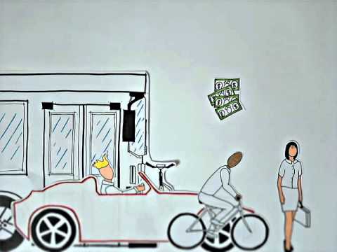 Watch this video to better understand how this project will improve safety and mobility for all users of the corridor regardless of how they choose to travel.