
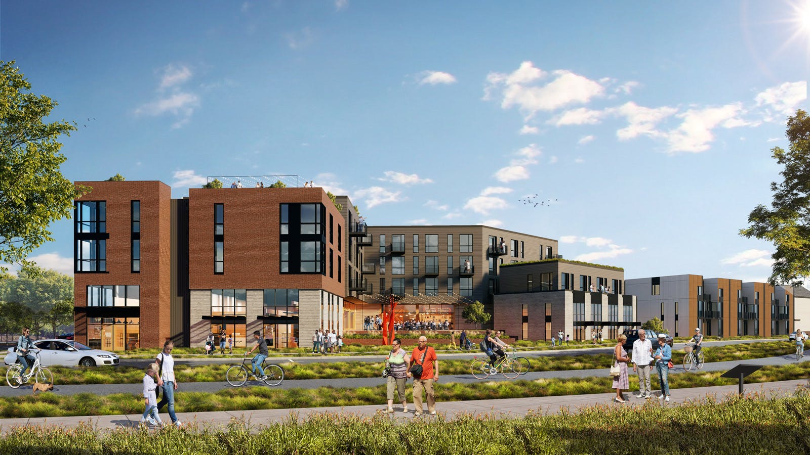
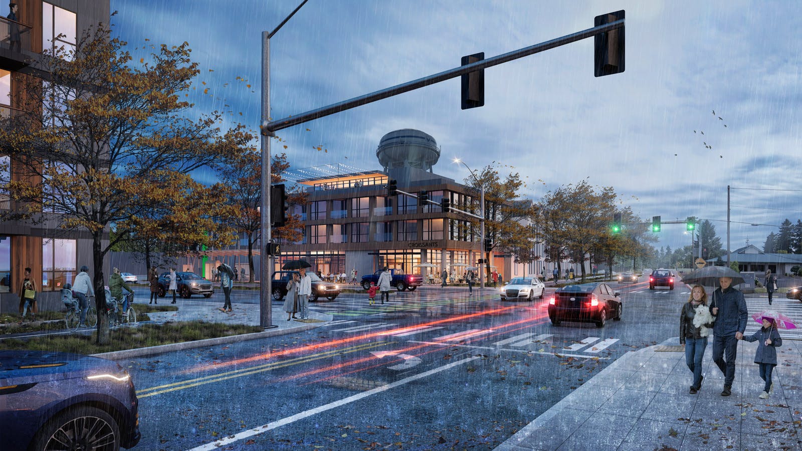
The Heights District

The Heights District is the result of a coordinated multiyear effort between the City of Vancouver and the community to redevelop the former Tower Mall and the surrounding area. This new district will be a vibrant, walkable, mixed-use neighborhood that is strategically located in the heart of Vancouver — a place where a mix of services and amenities, such as stores, restaurants, parks, schools and transit stations, are within a 20-minute walk.
The Civic Plaza
Within the center of the Heights District will be a new public plaza for gathering and events. The plaza is intended to serve daily activities while also accommodating a range of performances and multicultural events throughout the year. As the project team moves towards finalizing the design of the plaza, there will be a series of community engagement opportunities throughout the Summer and Fall of 2025. Our goal is to invite diverse voices from the surrounding community to uncover the unique stories, cultural meanings, and lived experiences that can inform the design of the plaza, creating a space that is not only reflective of place but also rooted in the people who live here. This engagement process will center on listening, learning and co-creation, bringing people together through a sense of belonging, and connection to both nature and community.

Development Phases
A Request for Proposal (RFP) for the second phase of development on the former Vanco Golf Range property adjacent to the Park Hill Cemetery is now live. The RFP was prepared by the Heights Community Investment Committee (HCIC). The HCIC comprises Vancouver residents who collectively hold over 50 years of experience in real estate development and financing and represent Central Vancouver businesses. The RFP prioritizes affordable homeownership. Proposals were required to be submitted in June, and developers will be selected by September 2025.
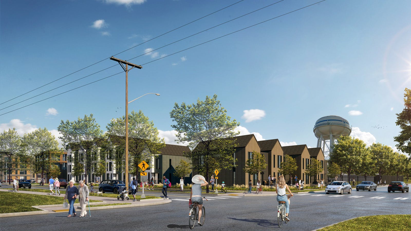
The development of the first phase of development is progressing. This includes three sites located at Mill Plain Boulevard and Devine Road which will be redeveloped into mixed income housing and ground floor retail and community space. Construction is projected to start in Q1 2027 and completed by Q3 2028. You can find more information about the projects and development teams on the Vancouver City website news page.
A successful 20-minute neighborhood includes streets that provide safe, direct and constant access to destinations for all community members. Whether you walk, bike, roll, drive or take public transit, we want to make it easy for you to get around. We also want public spaces to be open to people of all ages and abilities.
Amenities, such as a civic plaza and a neighborhood park, will support health and well-being through social interaction and physical activity. The district’s design will also emphasize the following:
- Universally accessible public areas and intersections, with curb ramps, level sidewalks and roadways, pavement and striping.
- Safety at intersections, through enhanced traffic signals, roundabouts that reduce vehicle speed, and crosswalks.
- Reduced vehicle delays and traffic conflicts, by way of traffic-signal timing, roundabouts, an added turn lane (in some instances) and sidewalks and bike lanes that are separated from vehicle traffic.
- Improved environmental health and reduced pollution, through the planting of trees for shade and clean air, plus landscaping to collect and clean street water run-off for improved water quality.
- Equitable public investment that will benefit all community members, including investments in infrastructure, facilities and programs for expanding access to affordable housing, jobs, education, healthcare and everyday resources.

As we advance the design of the plaza, we will be seeking feedback throughout the Summer and Fall of 2025 at various community events. More information to follow soon. From previous engagement, we heard the need for the following, all of which has been incorporated into the latest design:
- Inclusive, accessible outdoor spaces where everyone feels welcome
- Spaces for multicultural events and markets
- Covered areas to sit
- Safe place for kids to play
- Native plantings
- Water feature
This next phase of engagement is to further refine the design, specifically identifying ways to incorporate art and culture in an inclusive and thoughtful way to create a place where everyone belongs and feels welcome.
The Heights District is envisioned as a vibrant neighborhood center that is sustainable, healthy, equitable, accessible, and safe. It includes engaging public open space, diverse housing affordable to a wide range of community members and safe multimodal travel opportunities within the district and transit to nearby neighborhoods.
Updated Design and Engineering Elements
Designs to help guide the next phase of the Heights District are in development. We invite you to learn more below and to share your design ideas.
Some important features of a 20-minute neighborhood include streets that provide safe, direct, and continuous access to destinations for all ages, abilities and users, whether you walk, bike, roll, drive or take public transit. The image below shows the changes to be made to new and existing streets:

We are designing the streets in the project area to improve safety and accessibility in several ways, including:
- Wide sidewalks, lighting, and other features, such as benches for ease and comfort
- Bike lanes separated from vehicle traffic for protection
- Shared bike and car in low-speed roadways and roundabouts for efficient passage for all modes of travel
- Striped crosswalks and intersections for greater visibility
- Street trees and landscaping for improved air and water quality
- Traffic signals, roundabouts, and turn lanes for improved traffic flow

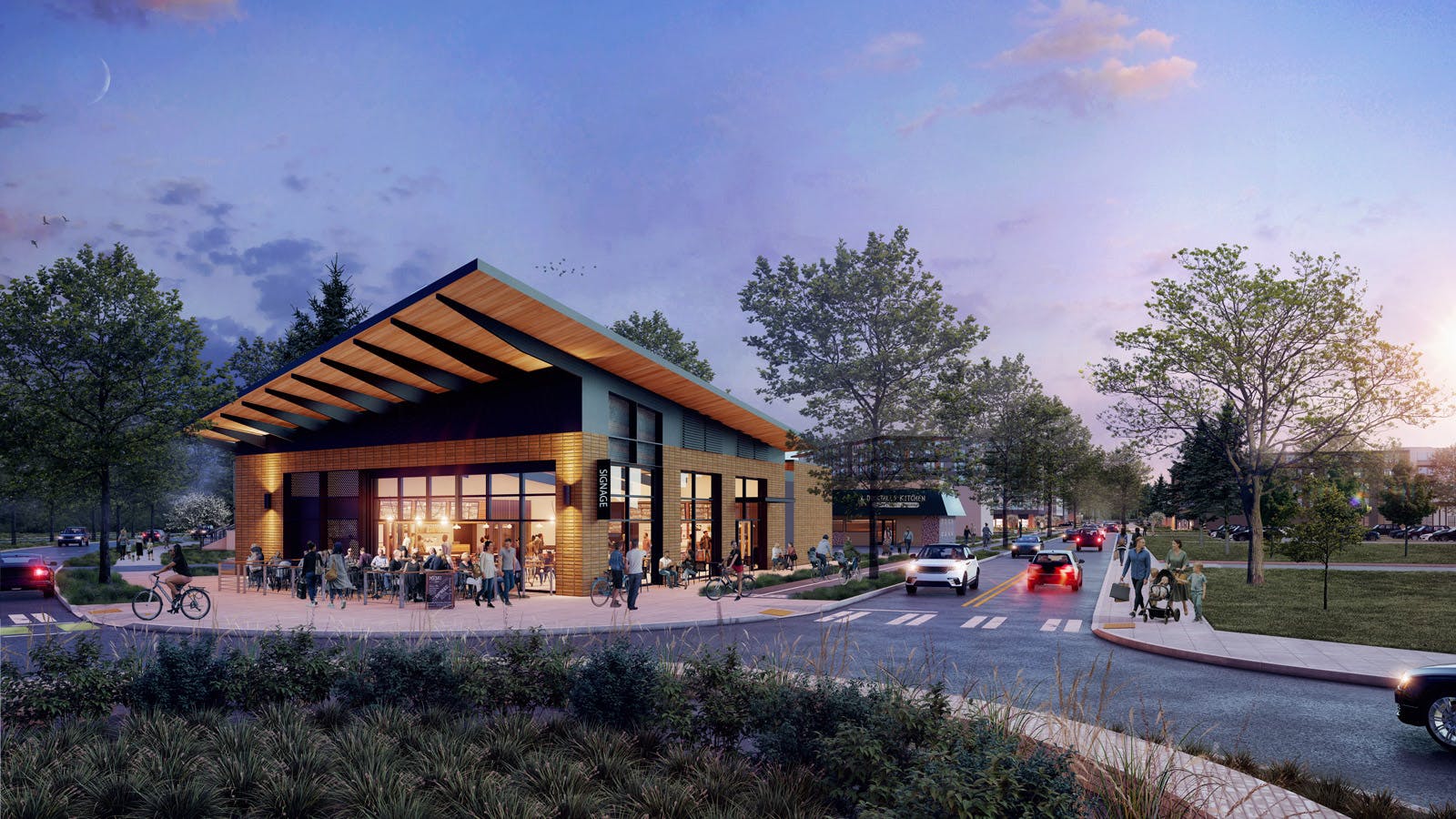
The Civic Plaza will be an informal gathering space, in the heart of the Heights District, surrounded by stores. It will be filled with a variety of features and able to be used in a variety of ways. Features may include:
- A water play area, such as a splash pad
- Flexible street for things like food, vendors, events, and cultural festivals
- Covered/canopy area
- Open plaza area for concerts, events, and socializing
- Retail stands
- Art and artistic elements
- Seating, such as benches, low walls, and movable tables/chairs
- Features to improve access for people who use a wheelchair or mobility device


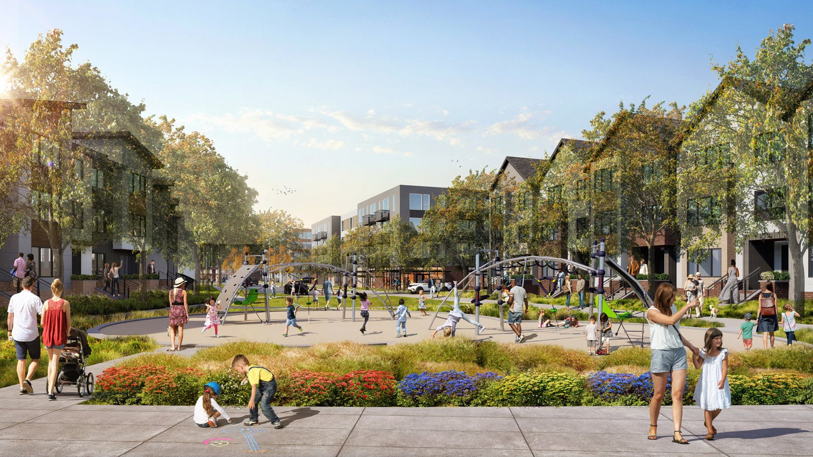
The neighborhood park will be a place for play, dog walking, strolling, picnicking, cultural events and more. Features may include:
- A large open lawn for relaxing, gathering, and holding community events, such as movies in the park, concerts and cultural festivals
- A dog park, water and waste supplies for pets
- Picnic tables, benches and movable seating
- Water fountains
- Bike parking
- Features to improve access for people who use a wheelchair or mobility device

When redeveloping large pieces of land, such as the Heights District, it’s common for property values throughout the area to increase. This can lead to unintended consequences, which make it harder for the people who live, work and own businesses in the area to stay.
The project team has finalized an Equitable Development Plan, which provides a citywide policy framework to inform how the City responds to existing displacement pressures. The plan incorporates anti-displacement strategies and equity into any public investments, including redevelopment by minimizing negative impacts on existing businesses and lower income residents, while also maximizing benefits for the entire community. The plan is to be used a tool box not just for the Heights redevelopment but Citywide. The full plan and appendices are available in the documents library folder (link to the folder). More broadly, the equitable development goals include:
- Provide housing for people and families at all income levels
- Retain and attract locally owned businesses
- Create opportunities for businesses owners from historically marginalized groups
- Support the creation of new businesses, which can meet the needs of local residents
- Offer a variety of employment opportunities that pay a living wage and are accessible to Vancouver residents from a range of educational and professional training backgrounds
- Connect residents to community services and amenities that benefit all ages and income groups

The Grand Loop will be a central feature of the Heights District, looping around the former Tower Mall area, extending to MacArthur Blvd and connecting the district to surrounding areas. Part street and part park, this path will wind through the district and encourage visitors to play, learn and explore. The Loop will feature outdoor dining, games, seating, landscaping and creative elements. It will also include signs to help you get around and art representing the local culture, history and environment.
The Grand Loop has four distinctive segments based off of Vancouver’s natural environment – volcanoes (Volcanology), waterways (Hydrology), trees and plants (Ecology) and rocks and land formations (Geology). Each section will have colorful designs, paving materials in the sidewalk and opportunities for learning, including play equipment, art and/or signage. An example is shown in the image below:

-
First developers selected for portion of Heights District Plan
Share First developers selected for portion of Heights District Plan on Facebook Share First developers selected for portion of Heights District Plan on Twitter Share First developers selected for portion of Heights District Plan on Linkedin Email First developers selected for portion of Heights District Plan link
On Monday, Aug. 26, City staff and the Heights Community Investment Committee (HCIC) presented their recommendations for development teams to City Council for the first three City-owned development sites in the Heights District, located at Mill Plain Boulevard and Devine Road, identified as Sites B, C and P.

The development teams were selected from a pool of applicants who responded to a Request for Proposals issued in March. After a thorough review process, the HCIC selected the following lead developers:
City Council supported the HCIC’s selections allowing staff to proceed with negotiating exclusive negotiation agreements (ENAs) with the development teams on each City-owned site.
“Getting the go-ahead from City Council to begin negotiating the ENAs that will govern each of the projects is a vital and necessary step in implementing the Heights District Plan,” said Height District Project Manager Amy Zoltie. “Each development team has confirmed that they can proceed expeditiously on this project, and all three teams have said in their proposals that they would be in a position to start construction in 2026, subject to securing financing.”
All three selected development teams have extensive experience with similar large-scale affordable housing and mixed-use projects like the Heights District. They have also demonstrated a commitment to equitable development through past projects and align with the goals outlined in the Heights District plan.
The HCIC was established in 2023 to guide the development of the Heights District as recommended in the Heights Equitable Development Plan. The committee consists of Vancouver residents with experience in affordable housing development and financing and representatives from Central Vancouver businesses and organizations.
City staff will begin negotiating the ENAs with each selected team and return to Council in September to seek authorization for the City Manager to execute the ENAs. Deal terms are anticipated to be negotiated by the end of the year with the presentation of the development agreements planned to go before City Council for its approval in Q1 2025.
View the preliminary project renderings for Sites B, C and P.
-
Heights Bike Garden Grand Opening
Share Heights Bike Garden Grand Opening on Facebook Share Heights Bike Garden Grand Opening on Twitter Share Heights Bike Garden Grand Opening on Linkedin Email Heights Bike Garden Grand Opening link
Join the City and our partners for the grand opening of Vancouver’s Heights Bike Garden from 10 a.m. to 1 p.m. Saturday, June 8 at 5411 Mill Plain Blvd.
The Heights Bike Garden was inspired by and designed in close partnership with Discover Traffic Gardens and will offer children a practical, fun way to learn biking skills, road safety and understand how traffic works. The bike garden will temporarily activate the vacant Tower Mall property for community use while work continues on the development of the Heights District.
Who's Listening
-

Email [email protected] -
Email [email protected]
Videos

Image Gallery
Document Library
-
 Civic Plaza Design Boards
-
 Heights Equitable Development Plan
-
Heights Equitable Development Plan Final Report (6.41 MB) (pdf)
-
Heights EDP Appendix A: Additional Details on Recommended Strategies (423 KB) (pdf)
-
Heights EDP Appendix B: How this Plan Builds off the Heights District Plan (1000 KB) (pdf)
-
Heights EDP Appendix C: Engagement Plan and Summary (355 KB) (pdf)
-
Heights EDP Appendix D:vHeights Market Analysis (6.5 MB) (pdf)
-
Appendix E_Equitable Development Best Practices and Case Studies.pdf (3.8 MB) (pdf)
-
Appendix F_Feasibility Analysis.pdf (4.55 MB) (pdf)
-
Appendix G_Strategy Evaluation Criteria.pdf (306 KB) (pdf)
-
-
Revised Masterplan (4.39 MB) (pdf)
-
Preliminary Project Design Renderings for Sites B, C and P (824 KB) (pdf)
-
RFP 29-25 Heights District_Final (1.43 MB) (pdf)

