
Upper Main Street Safety and Mobility Project
 Photo of Upper Main Street just south of NE 45th Street.What's Happening Now?
The Project team has drafted some early design ideas to improve safety and mobility along the Upper Main Street and asked the community what they think! We are now processing the feedback we've received from the community and the Transportation and Mobility Commission to refine and revise these design ideas.
Swing by our next presentation to the Transportation and Mobility Commission in person or online on July 2.
¿Que Está Pasando Ahora en el Proyecto de Upper Main Street?
El equipo del Proyecto de seguridad y movilidad de Upper Main Street ha desarrollado recomendaciones propuestas para abordar los problemas de transporte público que aprendimos de nuestro análisis técnico y la primera ronda de alcance público a principios de año.
- Regístrese para recibir correos electrónico
- Vea la presentación sobre el proyecto en la próxima reunión de la Comisión de Transporte y Movilidad el 2 de Julio.
What We Learned in Phase 1 of the Project
From our first round of engagement and our analysis of existing conditions, we learned that:
Sidewalks, where present, are narrow and directly adjacent to traffic. In some locations, sidewalks are missing, and the quality and gaps in sidewalks make them inaccessible to everyone.
There are long distances between marked crossings, particularly between 29th & 33rd Streets, and 33rd & 37th Streets.
Narrow travel lanes make it difficult for buses and large trucks to stay in-lane.
There are gaps in the bike and small mobility network in the northern segment of the project.
Wayfinding signage to off-street paths is limited and hard to locate.
The highest crash location along the project corridor is at the intersection of Main & 39th Street.
The most traffic congestion is at the intersections of Main & 39th Street and Main & 33rd Street.
There are on and off-ramps to I-5 and a wide roadway in the northern section of the project, which contribute to higher vehicle speeds.
Community members have identified the following priorities for the project:
Addressing road issues like potholes and striping.
Adding more sidewalks to fill gaps.
Implementing features like crosswalks to make crossings safer.
 The Upper Main Street Safety and Mobility Project is exploring ways to improve safety and mobility for all people using Main Street from Fourth Plain Boulevard to the northern city limits (just south of NE 63rd Street / Minnehaha Street).
The project will evaluate how Main Street can better meet the needs of people using transit, walking, biking, using a mobility device, and driving. This project is coordinating with planned pavement work in 2026 and the C-TRAN Highway 99 Bus Rapid Transit Project.
Para información en español, haga clic aquí.
Sign up for email updates to stay informed about the project and how to get involved. The project team will offer a variety of ways to get involved and provide input such as:
Swing by our next presentation to the Transportation and Mobility Commission in person or online on June 4.
¡Comparte tus comentarios sobre estas recomendaciones participando en nuestra encuesta o uniéndote a un evento en persona en Discovery Middle School el 17 de Abril!
- Regístrese para recibir correos electrónico
- Vea la presentación sobre el proyecto en la próxima reunión de la Comisión de Transporte y Movilidad el 4 de Junio.
What is the purpose of this project?
The Upper Main Street Safety and Mobility Project is taking advantage of upcoming paving and transit infrastructure work to make additional improvements to the roadway to safely serve all users. The project team will study ways to improve safety and mobility between Fourth Plain Blvd and the northern city limits (just south of NE 63rd Street / Minnehaha Street) for all travelers including people walking, biking, rolling, using transit, using a mobility device, and driving.
Why are safety and mobility improvements needed on Upper Main Street?
The City of Vancouver’s Westside Mobility Strategy and the Complete Streets Program identify Upper Main Street as a community corridor needing safety and accessibility improvements. Because C-TRAN is also investing in the Highway 99 Bus Rapid Transit (BRT) line along this corridor, and there is upcoming paving work, the City is able to leverage these investments to make improvements to the corridor while other work is being completed.
What are Complete Streets?
Complete Streets allow people to travel safely and comfortably regardless of age, ability, or chosen way to travel. This can look different for every street depending on land use, community needs, and the context of surrounding neighborhoods. Sometimes a Complete Corridor might use parallel streets for bike and small mobility users to create a more comfortable experience. Your input will help shape what a Complete Street looks like for Upper Main Street. The City of Vancouver’s Complete Streets Policy guides transportation planning and improvements.
What are the benefits of Complete Streets?
Complete Streets can help improve your quality of life. You can access the places and services you need regardless of your abilities or economic status. You feel comfortable and safe navigating your neighborhood. Complete Streets reduce crashes and injuries, promote healthy living, and encourage sustainable development. Examples of Complete Streets in Vancouver include McLoughlin Boulevard, SE Tech Center Drive, and Columbia Street between Columbia Way and West 45th Street.
How will you determine what improvements are needed along this section of Main Street?
This project includes a robust community engagement program. In fall and winter 2023 we will ask you about the challenges, needs, opportunities and priorities for people who live, work, go to school, and travel along the Upper Main Street corridor. We will use your feedback and data collected to shape a range of potential transportation design options. In spring 2024, we will ask you your preferences about these design options. After hearing your feedback, we will develop a recommendation that will be presented to the City of Vancouver’s Transportation and Mobility Commission.
Community engagement activities will include surveys, small group briefings, tabling at community events, neighborhood canvassing, and an open house event.
Are you going to reduce the number of traffic lanes?
The feedback gathered throughout this project will contribute to this decision, along with data about current and future use. Road striping design will be influenced by feedback from the community and operational partners like C-TRAN and other service providers, and traffic analysis to ensure the street meets the needs of current and future users.
Are you going to add bike lanes?
Currently, dedicated bike lanes do not exist between Fourth Plain Blvd and NE 45th Street on Main Street. Bicyclists must share the road with vehicles or use parallel routes like Columbia Street. Public feedback and traffic analysis data will help determine if bicycle and small mobility (BSM) lanes are needed and what type of BSM lane would be most appropriate for the corridor.
Are you making any improvements to existing sidewalks? Are you adding new sidewalks?
The project will help identify needs along the corridor. While the initial paving project will address in-roadway improvements between the curbs, with community input, the project may identify locations for future sidewalk infill and upgrades.
Are you making updates or improvements to side streets?
At this time, improvements will largely focus on Main Street between E Fourth Plain Blvd and the northern city limits (just south of NE 63rd Street / Minnehaha Street), including intersections.
How will this project affect my business on Main Street between Fourth Plain and Hazel Dell Ave?
Improving safety and mobility for all modes of transportation benefits everyone, including businesses. Customers and employees can reach you in the way they prefer. Safe, connected pathways for people walking, biking, and using small mobility devices (like scooters) help reduce roadway demand so freight can move efficiently. Complete Streets help create healthy, equitable neighborhoods and attract development opportunities. We will work with individual property and business owners through this process to avoid property and access impacts to the greatest extent possible.
When is construction expected to begin? How long will construction last?
Road repaving, transit improvements and restriping work will start in 2025 and continue in 2026 and 2027. Other long-term safety projects and other long-term mobility improvements identified will be implemented as funding allows.
What traffic impacts should we expect?
Information about traffic impacts will be available after a preferred design is selected and implementation plans are completed in coordination with C-TRAN and the Highway 99 BRT project. The City of Vancouver is committed to keeping impacted community members informed and minimizing traffic impacts as much as possible.
How is this project being funded?
Pavement improvements and road striping will be funded through local dollars. Other mobility elements (i.e., crosswalks, median islands, etc.) may be funded through a mix of local, state, and federal funds.
Documents
-
 Upper Main Street Info Sheet - English (2.7 MB) (pdf)
-
Vancouver Upper Main Street Info - Spanish (2.71 MB) (pdf)
-
Upper Main Street Existing Conditions Report (4.98 MB) (pdf)
-
Upper Main Street Phase 1 Engagement Summary (317 KB) (pdf)
-
Upper Main Street Phase 2 Outreach Boards (22.9 MB) (pdf)
-
 Transportation & Mobility Commission Materials
-
Upper Main Street TMC Memo July 2024.pdf (1.48 MB) (pdf)
-
Upper Main Street TMC Presentation July 2024.pdf (4.76 MB) (pdf)
-
Upper Main Street TMC Memo - June 2024
-
Upper Main Street TMC Presentation - June 2024
-
Upper Main Street TMC Memo - April 2024 (879 KB) (pdf)
-
Upper Main Street TMC Presentation - April 2024 (2.1 MB) (pdf)
-
Upper Main Street TMC Memo - March 2024 (216 KB) (pdf)
-
Upper Main Street TMC Presentation - March 2024 (2.79 MB) (pdf)
-
Upper Main Street TMC Memo - October 2023 (830 KB) (pdf)
-
Upper Main Street TMC Presentation - October 2023 (2.18 MB) (pdf)
-


Safety and Mobility Improvements Video
-
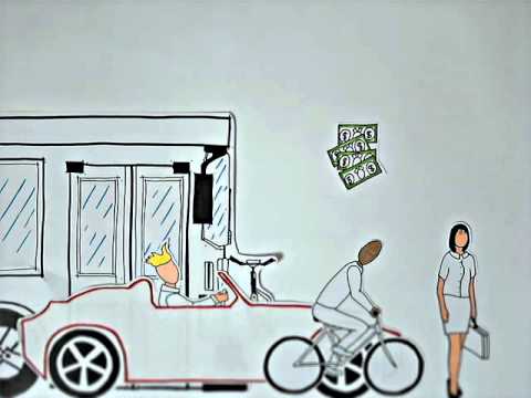 Watch this video to better understand how the Upper Main Street Safety & Mobility Project will improve safety and mobility for all users of the corridor regardless of how they choose to travel.