
SE 34th Street Safety and Mobility Project
Consultation has concluded
Project Overview
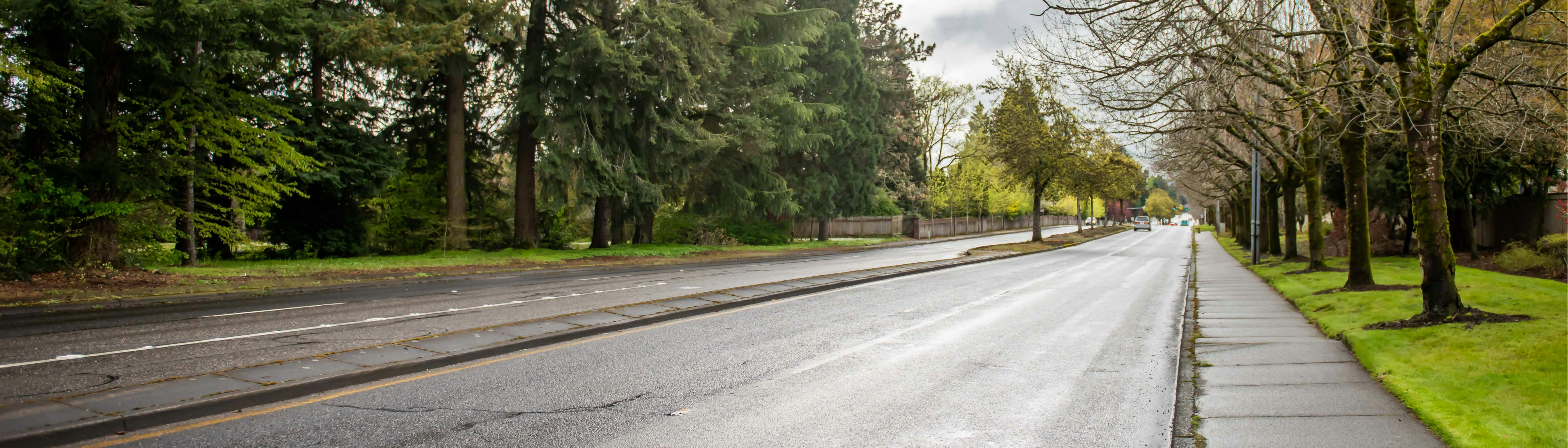
The SE 34th Street Safety and Mobility Project is an opportunity to help all community members get around safely between SE 164th and SE 192nd Avenues. You can learn more about the project background, funding and next steps below. We also invite you to participate in a community survey (encuesta en Español), share your feedback, or ask a question. We want to hear from you!
The SE 34th Street Safety and Mobility Project includes:
Safety and Mobility Study
We have evaluated potential changes to the street to improve safety and mobility for all users. This evaluation will consider:
- Repurposing a travel lane to add mobility lanes and/or shared facilities for people using a mobility device, walking and biking.
- Safety improvements at intersections and crossing to better accommodate people using a mobility device, walking and biking and traffic calming design features to reduce speeding.
To help make better decisions about how to improve safety and mobility and address equity along the SE 34th Street corridor, the City is engaging with you, the community, local organizations and partners, including C-TRAN, the Vancouver Innovation Center, Evergreen Public Schools and more.
Design Plan
After research and hearing community feedback, we have an design plan for the corridor!
This design incorporates the three goals of the project; to improve mobility for all users, prioritize safety, and use low-cost solutions that can be implemented quickly. We will use this initial design plan to inform the pavement treatment planned for 2024.
The proposed design option will achieve the Project goals by:
- Creating a new east-west mobility corridor
- Improving access to transit for people walking, biking, or using a mobility device
- Not substantially adding to driver delays over the next 10 years
- Slowing down vehicles to improve safety for all users
- Including design features that can be completed with the paving project
- Not requiring large capital investments over the next 10 years
- Including safety improvements that would be eligible for grant funding

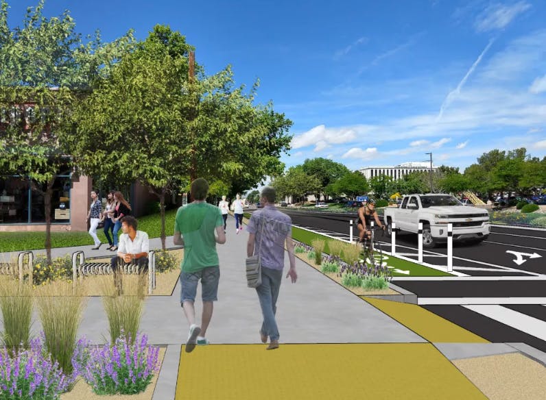
Proposed Design Elements
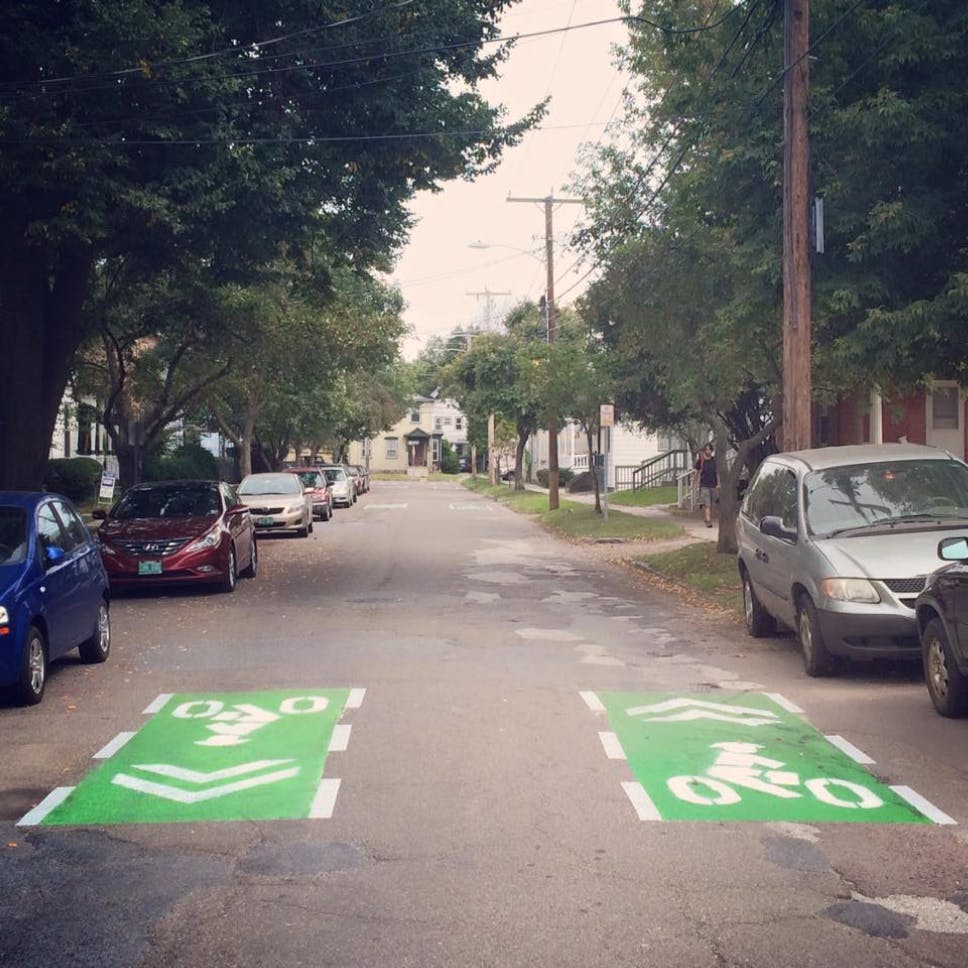
- Mobility Lanes will provide dedicated and separated space for people biking and using active mobility devices. Between intersections, the mobility lanes will be as wide as eight feet to allow for passing or for riding side-by-side.
- Green bars extending the mobility lane through the intersections will make it clear to people driving that people using the mobility lanes may be crossing the street.
- Modular bus platforms will maintain ADA access to buses and minimize potential conflicts between buses and mobility lane users. The modular platforms will also allow buses to stop in the travel lane, improving transit travel time on SE 34th Street.
- High visibility crosswalks will make pedestrians more visible to vehicles and more effective for getting drivers to stop for pedestrians.
- Vertical barriers will provide physical separation between the mobility lanes and vehicle travel lanes.
- The vehicle travel lane will be narrowed to 11 feet from 12 ft. This will help to lower vehicle speeds on the corridor and create more space for the mobility lanes.
- A painted buffer will separate the mobility lane from the vehicle travel lane. The painted buffer will be between eight and five feet wide along the corridor.
Project Background and Funding
This project is just one example of how the City is implementing projects to improve safety and mobility in Vancouver. The following plans and ordinances informed the SE 34th Street Safety and Mobility Project:
This project is made possible through partnerships with the City's Pavement Management Program, local funds, and other available resources.
Pavement Project
Microsurfacing treatment to protect and extend the life of the street. The pavement treatment project will start construction in the summer of 2024.
Microsurfacing is a form of pavement preservation that protects and extends the life of the street. It is much more cost effective than pavement resurfacing.
Microsurfacing begins as a coarse liquid application of dense-grade aggregate, asphalt emulsion, water and mineral fillers. The quick-setting emulsion allows traffic to begin using the new surface in a short time—as little as an hour depending on conditions. As time passes, the surface becomes smoother. The finished sealant forms a thin shell over the street's existing asphalt surface, extending the life of the underlying pavement.
Microsurfacing applications are generally applied on arterial and higher volume streets, such as SE 34th Street.
Improvements will also be made adjacent to the project area on SE 176th Avenue between SE 34th Street and SE 20th Street to add protected bike lanes. This project will be completed in partnership with a 2024 City Pavement Management Program project.
Next Steps
Thank you for taking the time learn about the SE 34th Street Safety and Mobility Project, sharing your feedback and asking questions.
Please sign up to receive email updates about the project.
Learn more about this project at: www.cityofvancouver.us/business/planning-development-and-zoning/transportation-planning/complete-streets/se-34th-street/
Do you have a question about the SE 34th Street Safety & Mobility Project? Let us know here!
Directions: Project staff will respond to your questions as soon as possible. For the most part, your question and our answer will be visible to all users after we respond to it. Should we need to ask a clarifying, follow-up question, we may respond to you privately instead.
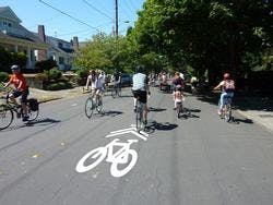
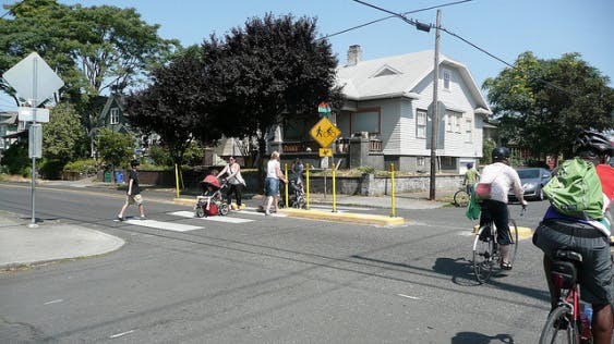
Safety and Mobility Improvement Photos

Safety and Mobility Improvements Video
-
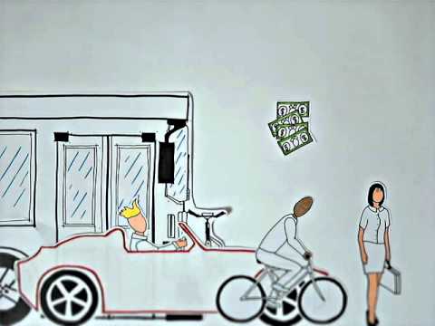 Watch this video to better understand how the SE 34th Street Safety & Mobility Project will improve safety and mobility for all users of the corridor regardless of how they choose to travel.
